Home › Plan a trip Plan a trip into the Little Belts
Today's weather and roads, the six ways in, day trips and weekends, and the tools that keep working up the canyons with no signal.
Today in the mountains Live from the National Weather Service. Kings Hill makes its own weather, so check both.
Neihart National Weather Service
Kings Hill Pass National Weather Service
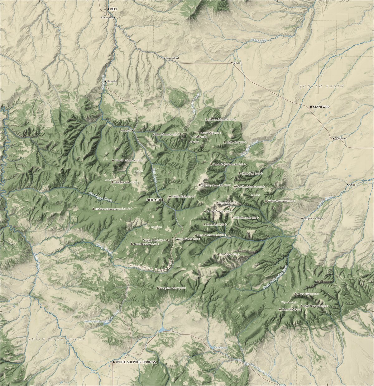
Six roads in From the paved byway over Kings Hill to the dirt roads up the creeks. Tap a number, or show the campgrounds, cabins and trailheads.
Fly them in 3D
NEIHART Tap a number for that road in, or a dot for a campground, cabin or cam. The Highwood Baldy cam is just off the top of this map.
1 US 89 Up Belt Creek from Great Falls
From Great Falls: 58 road miles to Neihart, 1 h 20 min Road Paved, open all year Gas Belt, Neihart 2 US 89 Over Kings Hill from White Sulphur Springs
From White Sulphur Springs: 40 road miles to Neihart, 1 h Road Paved, open all year (Kings Hill Scenic Byway) Gas White Sulphur Springs 3 US 87 FOREST RD 251The north face, from Stanford
From Stanford: 55 road miles to Neihart, 1 h 25 min Road US 87 paved; Dry Wolf Road is dirt, open to cars Gas Stanford 4 FOREST RD 120Hughesville and Barker, from Monarch
From Monarch: 13 road miles to Neihart, 20 min to Monarch Road Dirt; the Forest Service lists it open all year Gas Neihart, Belt 5 FOREST RD 266The Judith side, from Utica
From Utica: 71 road miles to Neihart, 1 h 55 min Road Dirt; Yogo Creek road listed open all year Gas Stanford 6 US 89 FOREST RD 119The Smith River side, Sheep Creek
From White Sulphur Springs: 40 road miles to Neihart, about 1 h Road Gravel; Sheep Creek road is seasonal Gas White Sulphur Springs
Day trips & weekends Road miles and drive times from a routing engine, for dry roads.
The Kings Hill Scenic Byway 98 road miles about 2 h 20 min of driving Paved, all year
Great Falls to White Sulphur Springs on US 89, right through the middle of the range.
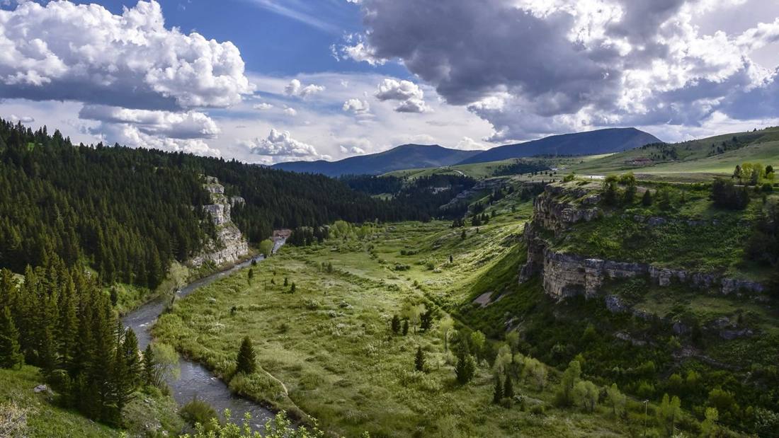
Great Falls Armington Junction Where US 89 leaves US 87 Sluice Boxes State Park 200-foot cliffs over Belt Creek Monarch Neihart and Memorial Falls 58 road miles from Great Falls Showdown and Kings Hill PassThe top of the byway White Sulphur Springs Natural hot pools; 40 road miles from Neihart A weekend in a Forest Service cabin 6 in the Little Belts Book on Recreation.gov
Old guard stations and a fire lookout you can rent by the night. Prices as the Forest Service lists them.
Kings Hill Cabin7 mi south of Neihart · $75 a night · Book Dry Wolf Cabin13 mi northeast of Neihart · $55 a night · Book Calf Creek Cabin13 mi southwest of Neihart · $55 a night · Book Monument Peak Lookout17 mi west of Neihart · $45 a night · Book Hunters Spring Cabin21 mi southeast of Neihart · $65 a night · Book Judith Guard Station Cabin22 mi east of Neihart · $60 a night · Book Ghost towns and mining camps Dirt roads Summer and fall
The Little Belts were silver and lead country. Some of it still stands.
Neihart A mining town since the 1880s; see it in 1950 on our channel Hughesville and Barker Up the Dry Fork of Belt Creek from Monarch Ace in the Hole and the Carroll Trail Roadside history Castle TownThe old camp in the Castle Mountains, 34 miles south All the way around the range 247 road miles about 5½ hours of driving
A long loop through the towns that ring the Little Belts.
Neihart Start here White Sulphur Springs 40 miles from the last stop Harlowton 58 miles from the last stop Judith Gap 19 miles from the last stop Stanford 50 miles from the last stop Belt 42 miles from the last stop Neihart 38 miles from the last stop
Gas Fill up in Belt, White Sulphur Springs or Stanford. Neihart has one fuel stop, and small-town stations keep their own hours.
Hospitals Closest to Neihart: Mountainview Medical Center in White Sulphur Springs, 40 road miles. Great Falls has two, 58 road miles.
No signal Phones go quiet in a lot of these canyons. Open this site before you go: the pages you've seen, your trip and the tools keep working.
Help Emergencies: call 911. Forest Service: Belt Creek Ranger Station (7 miles), White Sulphur Springs (28), Judith at Stanford (29).
Cabins & lookouts
Campgrounds
Hospitals & rangers
Rent from the Forest Service Miles Kings Hill Cabin 6.8 Book Dry Wolf Cabin 12.6 Book Calf Creek Cabin 13.0 Book Monument Peak Lookout 17.5 Book Hunters Spring Cabin 20.9 Book Judith Guard Station 21.9 Book Thompson Guard Station 36.5 Book
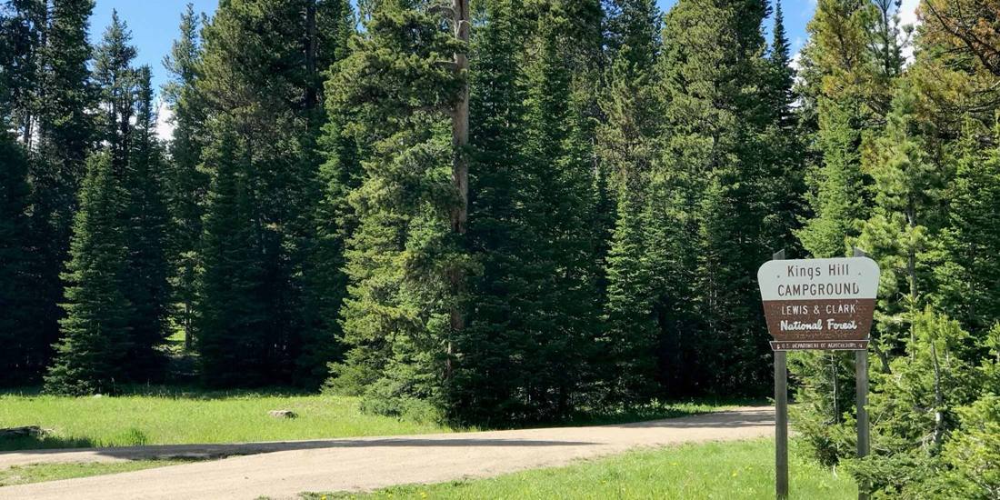
Campground Miles Many Pines Campground 3.4 Details Aspen Campground 4.2 Details Kings Hill Campground 6.7 Details Moose Creek Campground 9.4 Details Dry Wolf Group Campground 10.6 Dry Wolf Campground 10.8 Details Jumping Creek Campground 12.0 Details Logging Creek Campground 17.2 Details Hay Canyon Campground 22.7 Details Grasshopper Campground 27.0 Details Richardson Campground 27.2 Details Spring Creek Campground 27.3 Details
Hospital Town Miles Road miles
Mountainview Medical Center White Sulphur Springs 28 40 Benefis Hospitals Great Falls 47 58 Great Falls Clinic Hospital Great Falls 47 58 Wheatland Memorial Hospital Harlowton 55 92 Central Montana Medical Center Lewistown 62 99
Miles are from Neihart as the crow flies unless they say road miles. Cabins, campgrounds and offices: USDA Forest Service. Hospitals: Medicare's hospital list.
By the numbers
The Little Belts
899,000 acres of national forest
745 miles of Forest Service trail
10 campgrounds, plus 457 dispersed camp spots
6 cabins and lookouts to rent
6 live webcams
630 miles of forest road open to vehicles
51 towns within 100 miles of Neihart
108 videos on our channel
Forest Service and OpenStreetMap data, October 2026.
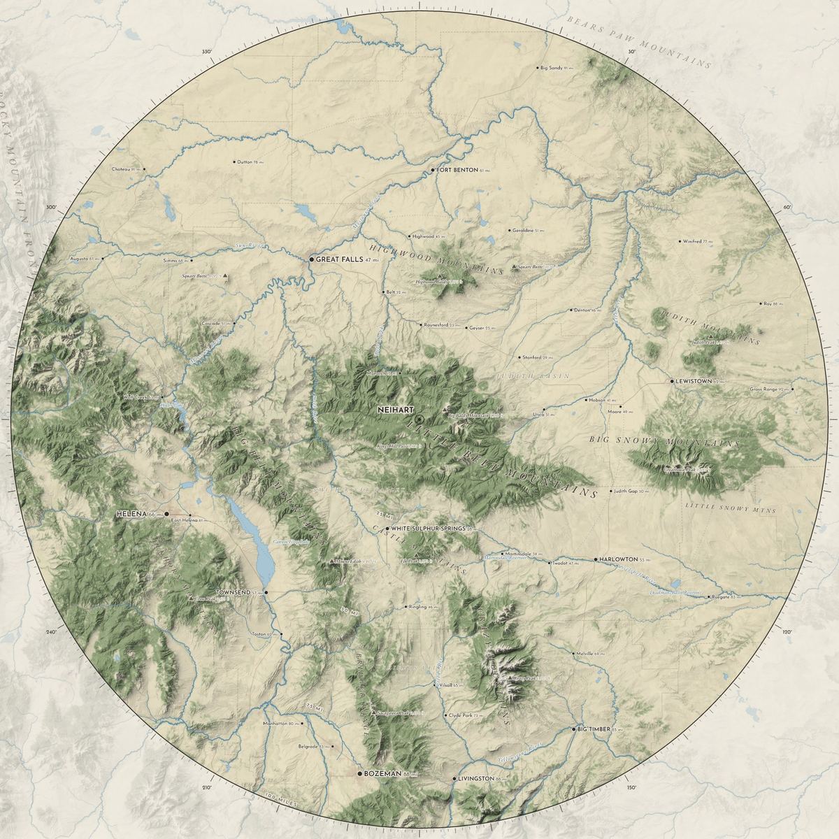
The 100 miles The Little Belts get the most detail. Around them, every town and range within 100 miles of Neihart.
Little Belts Big Belts Castles Highwoods Crazies
Town Miles Road miles Drive Monarch 12 13 18 min Raynesford 23 29 54 min Belt 32 39 54 min White Sulphur Springs 28 40 1 h 0 min Stanford 29 55 1 h 24 min Great Falls 47 58 1 h 18 min Utica 30 71 1 h 54 min Townsend 56 82 1 h 48 min Harlowton 55 92 2 h 18 min Lewistown 62 99 2 h 12 min Livingston 88 112 2 h 42 min Helena 66 116 2 h 30 min Big Timber 85 134 3 h 0 min Bozeman 88 146 2 h 54 min