High Mountain Access 7,285
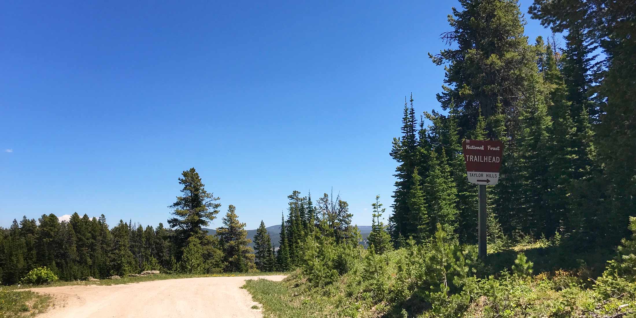
The access has parking, loading and unload ramp, hitching post, and an information sign. There is only one 2-3 mile long distinguised ATV route that will take you to the top of Taylor Hills, but with a motorcycle there is a route back towards Monument Peak and another that loops and connects with Balsinger Trailhead. Logging Creek Campground is located only 5 miles/15 minutes minutes away to the north and is a great place to camp if you need more than one day to explore this area. Remember you will be sharing this trail with other people; hikers, bikers, ATV and horseback riders.
Directions to Taylor Hills Trailhead
From Highway 89 take Evans/Riceville Rd: 24.6 miles / 1hr 6 min
Turn onto Evans Riceville Road from Highway 89 and drive 12.6 miles until you reach Logging Creek Road and take a right - continue on Logging Creek Road for 9.7 miles until it turns into Divide Road and continue 2.2 more miles. Trailhead is on the right with signs clearly marking the area.
Info & Contact
| Dates Open Call 406.236.5511 | Shared ATV, Horse, Mtn. Bike, Hike |
| Elevation 7,285 ft | Pets Allowed Yes |
| Distance From Highway 24.6 miles | Cell Phone Coverage 0 of 10 |
| Fee $0 | Highway 89 |
| Handicap Accessible No | County Cascade |
| Sign in Box Yes | Mountain Range Little Belt |
| Trailer Parking Yes | Nearest Town Belt, MT |
| Bathrooms 0 | Ranger District Belt Creek |
| Water No | Phone Number 406.236.5511 |
Nearby Trailheads
Other trailheads located close to Taylor Hills:
- Deep Creek 5.2 miles northwest on Divide Rd.
- Balsinger 5 miles east on Divide Rd.
- South Pilgrim 6.5 miles east on Divide Rd.
Location
Download Motor Trail map HERE